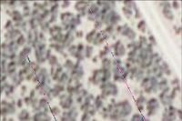
I've got a new tool for displaying the results from line intercept mapping in GIS. You can download that tool HERE .
Line intercept is one
of the most common sampling methods of sampling in ecology. Despite its
widespread popularity a lack of tools exists for automatically importing
and visualizing line interrcept data in a GIS. This tool alleviates
this problem making line intercept mapping easier. The tool can be run
using any of the three licensed versions of ArcGIS and does not require
any extensions. The tool is capable of generating overlapping line
segments. The tool does not require linear referencing because transect
lines are assumed straight. The tool requires that your data be in two tables: a transect
coordinate table and a start-stop table. The transect coordinate table
should have four fields: a TransectID, easting (or longitude for the GCS
version of the tool), northing (or latitude for the GCS version of the
tool), and supposed line length (length of the line as measured in the
field). The start-stop table requires four fields: a TransectID, a start
distance, a stop distance, and at least one field with a descriptive
attribute that you are trying to map.
With this blog I intend to share GIS, remote sensing, and spatial analysis tips, experiences, and techniques with others. Most of my work is in the field of Landscape Ecology, so there is a focus on ecological applications. Postings include tips and suggestions for data processing and day-to-day GIS tasks, links to my GIS tools and approaches, and links to scientific papers that I've been involved in.
Subscribe to:
Post Comments (Atom)

No comments:
Post a Comment