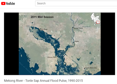
Southeast Asia experiences dramatic swings in precipitation and river flows as a result of the Asian monsoon. Nowhere is this more dramatic than the Mekong River flowing through Cambodia and Vietnam. In Cambodia the mighty Mekong River winds its way across a vast flood plain. During the rainy season the flow of the Mekong increases so much that it reverses the flow of the Tonle Sap River increasing the size of the Tonle Sap Lake by 6 times or more. This animation shows the heart beat of the Mekong River, the annual flood pulse using data derived from Landsat satellites from 1990 to 2015. Some years are omitted due to cloud cover.
To view the animation on YouTube click HERE
With this blog I intend to share GIS, remote sensing, and spatial analysis tips, experiences, and techniques with others. Most of my work is in the field of Landscape Ecology, so there is a focus on ecological applications. Postings include tips and suggestions for data processing and day-to-day GIS tasks, links to my GIS tools and approaches, and links to scientific papers that I've been involved in.
Friday, July 13, 2018
Animation of the Mekong River - Tonle Sap flood pulse
Labels:
Cambodia,
climate,
flood pulse,
hydrology,
Mekong,
Mekong River,
monsoon,
rain,
time series,
Tonle Sap
Subscribe to:
Post Comments (Atom)
No comments:
Post a Comment